Thursday, October 8, 2020

Following the Yellowstone Trail to the Red Brick Road


By October 6, we had been on the road for a week. We had camped nearly every night across Montana, Idaho and Washington. These nights were spent in a primitive, yet cozy tent trailer. We did not have water in the trailer and all of the electricity, when we had electricity, was furnished via an extension cord. One night we used an electric heater inside the trailer on other nights we relied on our warm sleeping bags. 

We decided to spend the night of October 6 in a motel in Wenatchee. Not only would staying in a motel be a welcome rest, but it would give us a chance to recharge our batteries, both our personal batteries and the ones for the electronic devices. They were spent too.


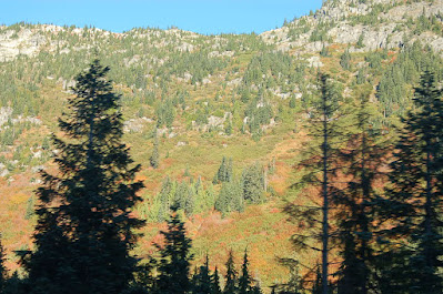
On the morning of October 7 we left the motel and began the climb toward Stevens Pass. We were on U.S. Highway 2. We soon left the orchards and rich farmland of the Wenatchee Valley behind. The road was not crowded, but it was winding so we settled in and enjoyed the spectacular scenery. The fall colors were as good as or better than those in Montana.


The first town we came to was Leavenworth. Leavenworth began life as a railroad town along the Great Northern Railroad. When the railroad was no longer providing a stable economic foundation for the town, it reinvented itself as a Bavarian village. It's number one industry now is tourism. We were driving through as the town was getting ready for Oktoberfest tourists, but it was early enough in the morning that we were not slowed down and we did not stop to enjoy the sights. We've been to Leavenworth before, and we will visit again.


After cresting the pass we began the long descent towards the Puget Sound area. At Snohomish, we left Highway 2 and drove towards Redmond, Washington. We were in search of "The Old Red Brick Road" which was paved with bricks in 1913 and is a part of the Yellowstone Trail. The instructions for getting to the road were not good. One device took us to Kirkland. It was actually a train store we ended up at - (really Bill?  It was a former trip when we were in the area last year.) Another said it was in the town of Bothell, while another tried to take us to Everett and yet another set of directions led us to Redmond. I even stopped at the Bothell City Hall where I was stopped by signs indicating that the area was under quarantine due to Covid 19.
I spoke with a nice woman on the phone that works for the city and she told me that there is a "Red Brick Rd., Park" in the city but that she wasn't sure if the Red Brick Road was there. It was not.  We ultimately found it and it turns out that it is 196th Avenue Northeast in Redmond. We drove the mile-long section of "The Red Brick Road" and took some pictures. There is a nice interpretive sign at the beginning of the road in Redmond. The Yellowstone Trail is prominently mentioned.


 The history and significance of "The Red Brick Road" started before it had bricks and before 1913. In 1909 the transcontinental race from Boston to Seattle drove on this street as it was nearing the finish. The race was won by a model T Ford. Henry Ford was on hand to witness the end of the race.


We then went to search for the end of the trail. That proved
easier to find than the 2 1/2 hour search for the "Old Red Brick Road". As it turns out the Yellowstone Trail ends at Pioneer Square, near the ferry terminal in Seattle. This proved easy to find and in a short 25 minutes we were at "The End of the Trail". In one sense this finishes our travel diary. It began in 2017 in Boise, foundered in San Francisco and then traveled the Lincoln Highway to Times Square in New York City, where we drove north to Plymouth Rock. At Plymouth Rock we began our trip west on the Yellowstone Trail. The Yellowstone Trail proved very difficult to follow many times. But by and large it truly is "A Good Road from Plymouth Rock to Puget Sound".

Tomorrow we will start our trip home. We are not giving up on the Yellowstone Trail. We will drive the 1913 route through Yakima, and the Tri-Cities. At that point we will part with the Yellowstone Trail in drive Interstate 84 back to Boise.


This trip has been a great and grand adventure. We met a lot of people all of them friendly and helpful. There was not a "stinker" in the bunch. The last part of the trip, from Yellowstone Park to Puget Sound was delayed for three years for a number of reasons. One of these reasons was that I thought this portion of the road might be anticlimactic. It wasn't. The route through Western Montana and the search for the red brick road in western Washington proved to be to the most scenic and rewarding portions of the entire trip.


Tuesday, October 6, 2020

Racing Across Washington


The Yellowstone Trail wanted to be considered at the same level as the Lincoln Highway. In 1916 the Yellowstone Trail Association issued a challenge to the Lincoln Highway, challenging that Association to a cross-country race with each Association using its own highway. For whatever reason the Lincoln Highway Association did not respond to the challenge. I suspect that they felt that as the preeminent Highway Association they had little to gain and much to lose in any such race. 

 Despite the fact that the Lincoln Highway association begged off on the race, the Yellowstone Trail Association went forward anyway. They raced from Plymouth Rock to Puget Sound. The Yellowstone Trail Association's efforts took five days one hour and 12 minutes. This established a new record for transcontinental travel. In that effort the Yellowstone Trail's drivers took the route due west from Spokane across Washington. This eliminated more than 150 miles from the trip. Ultimately that route would become the Yellowstone Trail in its final incarnation. This is the route that we are taking today. We will return on the pre-1916 route going down through Sunnyside and over to the Tri-Cities before returning home. 

 Yesterday morning we began our daily drive from our campground in Coeur d' Alene, Idaho.


As you can see, we were the smallest "rig" in the campground. Our destination was only about 45 miles away, Riverside State Park in Spokane. In law school, Linda and I would often go camping at Riverside State Park in order to give us a break from the trials of law school and also to go shopping as Moscow, Idaho had very little in the way of shopping in the mid-1970s. We have fond memories of Riverside and our camping expeditions there. I guess we were hoping to relive these experiences, but this trip disappointed us in that regard. 

 Riverside is becoming overused. In addition, the Covid 19 restrictions meant that the water for campers was turned off. (Why, I really don't know?) Camping everywhere has been crowded. But with many Washington state schools closed, this meant that there were a lot of kids in the campground. This is not so bad in and of itself, but the five kids in the campsite next to us "were free range" children. We were disheartened that they didn't respect outdoor rules of courtesy. Their parents didn't keep them quiet and even seem to encourage their yelling and screaming. 

The Davenport Hotel in Spokane is quite grand.  Louis Davenport was the proprietor and overseer of the building of it.  It has the distinction of being the first hotel in the United States with air conditioning. 


 After getting a reasonably good night sleep, we broke camp when the children in the next campsite awakened us. After a quick coffee, we got on "The Sunset Highway" in Spokane, the name given to Highway 2 in Washington, and headed west. It travels on an east-west route across the state. By and large, it is a good road, but there are not many towns along the route. 


The scenery is interesting in his own way. We first came across "The Washington Scab Lands", which is a remnant of the flood when the ice dam which formed Lake Missoula, released the water which resulted in a flood across Northern Idaho and into Eastern Washington. In places the flood deposited tons of rich soil which can be seen in the rolling Hills of the Palouse.
 

In other places the flood scoured the land and left it devoid of vegetation and topsoil. This is the case in the scab lands. The soil reminds me of the Loess soil of Western Iowa which we observed during the 2017 Lincoln Hwy. conference. The Palouse soil is just as rich as the soil of Western Iowa, but it was formed in a vastly different way. 

Just west of Spokane we passed through the town of Davenport, Washington. The town is named for its founder, John C Davenport, not the Davenport who was founder of the Davenport Hotel. (Although the two may have been related.) The Courthouse, built in 1897, was an important center for the residents until 1995. It was burned  to the ground by a local teen. It was painstakingly restored, including the original iron fence that had been removed to aid in the war effort of  WWII. 


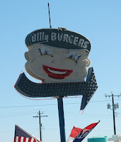
From Davenport we continued due West and soon passed through the little community of Wilbur, Washington. There was a hamburger stand here which serves "Billy Burgers" and also a tribute to Charlotte's Web. There is a statue of Wilbur the pig and next to Wilbur is a spider's web featuring Charlotte. West of Wilbur we passed through Coulee City, home of the Grand Coulee Dam. 


We continued through central Washington until we came to the town of Wenatchee. Wenatchee is on the west side of the river across from East Wenatchee.


East Wenatchee is the home of the Ranchero Roundup. That of course is the largest gathering of Rancheros on the planet. But Wenatchee has its own claim to fame. It is regarded as the Apple capital of the world. 


Monday, October 5, 2020


We began our day in Missoula, Montana. We left Jill and Jerry's house early in order to do some sightseeing on campus and to have breakfast with Mary Therese, one of Linda's college friends. We began the day without knowing our exact route, our stops, what we were going to see, or what time we would end the day and where we would end the day. Despite this recipe for disaster it worked out to be one of the most memorable and enjoyable days of this entire trip.(Which began in June 2017.)                                                                                                 


In Missoula we stayed with Jill and Jerry, the same friends we stayed with when we had our car trouble in the Bay Area. Jill and Jerry spend summers in Missoula with Jill's mother Pat. The threat of COVID means Pat needs some extra attention to make sure adequate precautions are taken.

While in Missoula I found myself thinking a little bit about the fraternity and sorority system in Montana. Most of the houses have closed. I found out that my fraternity still exists, but that the members are living in the dorm. Linda's sorority continues, but does not appear to be as strong as it once was. At best, the University of Montana barely tolerates the Greek houses.

Main Hall University of Montana

There are good and bad things about this type of structure. On the good side, we truly had to manage the house that we owned. On the bad side, it became a bit of an "animal house". The drinking age in Montana was 18 when I was attending UM. This produced a lot of human wreckage both in the dorms, but especially in the Greek houses. At the University of Idaho and many other schools, the fraternity houses and the property they sit upon our own by the University which leases it to the Greek houses. This allows the University some measure of control over the students and gives a stable foundation to the houses. 


Missoula pretty much always has always been a prosperous Montana community. It is now very liberal. In the 60's and 70's it had a little bit more of a split personality. The University community was liberal, perhaps even radical, but the rest of the town was made up of bankers, businessmen and financiers. That meant that the business conservatives at a chance of electing members of local government and representatives to the legislature. Representatives to the state legislature from Missoula might be Democrats for some years and Republicans in others. Now, they're pretty much all liberal Democrats.

Here are some photographs from our walks around town over the past couple of days:


As you can see, the campus and all of Missoula for that matter were resplendent in the fall colors.

We left Missoula and drove west on Interstate 90. The interstate crossed and re-crossed the Clark Fork River. While most of the towns had an interstate access, it is almost impossible to drive old US 10 from Missoula to Coeur d' Alene.

The old roads are victims of mountain geography. Just like the Sierras in California and the Rockies in Colorado there are only a few places where narrow mountain passes exist. The old road has to be obliterated to make way for the new highway. So as we drove Interstate 90 we just had to satisfy ourselves with the knowledge that we were in the vicinity and perhaps even driving on US 10, the Yellowstone Trail and the Mullan Road. We made a point to get off the interstate and drive the old loops wherever we could.      


One point where we exited the highway was east of St. Regis, at Cyr where we drove a segment of US 10 over a steel bridge crossing the Clark Fork River and then back on the interstate. We drove on west to St. Regis. At exit 70, we drove portions of old US 10. A few yards to the north, I thought I spotted another old roadbed. So we stopped the car and I walked about  20 yards to the roadbed on what I think was a segment of the original Yellowstone Trail.


I know that if I am wrong someone will correct me. Along this road I saw a remnants of the post which supported an old guardrail.


We left the interstate again at St. Regis, Montana and took a route known as: "The Camel's Hump". "The Camel's Hump" was used for a few years.


I believe that the name came from a hill to the right of the roadway where we entered the mountain. The hill looks like a camels hump. We drove approximately 8 miles on this segment. It was quite interesting and one of the most beautiful segments of the Yellowstone Trail. 


Along this segment of road there is a Forest Service campground called: Circle City. I believe the name comes from a private campground near the town of de Borgia where "Circle City" was located. (It was a campground that dates back to the1920's, but as travelers began demanding better facilities, campground owners started building cabins.)  In de Borgia stands the old Albert Hotel. ( Mr. & Mrs. Albert advertised in the 1928 Route Guide, "clean rooms, first class restaurant, soft drinks, cigars, etc. Road information accurately given".)


This hotel survived the great fire of 1910. Fortunately, east of the hotel is "The Black Diamond Guest Ranch". The owners of the guest ranch purchased most of the cabins from "Circle City" and moved and restored them. Today, the cabins are available for rent. The owners also have horses and lead guided tours of the backcountry.


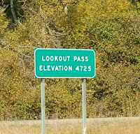
Lookout Pass, Id Dept. of Trans. photo

We returned to the interstate and drove to Lookout Pass. At Lookout Pass we entered Idaho. As we descended the pass, we stopped at the town of Mullan and drove to the city of Wallace. Wallace is the county seat of Shoshone County. It was also the site of a silver mine. There was a fire in the mine in the late 1970's, which killed many miners. There is a monument to the fallen miners between Wallace and Kellogg. Wallace, being a mining town was, like Butte, "wide open". Prostitution and gambling existed until the early 1980s. Just like Butte, you can tour the old houses of prostitution.


The courthouse in Wallace sits upon the main street. It is a majestic looking structure. There is also the "Stoplight Diner" which commemorates the last stoplight on Interstate 90 which existed in Wallace. Because of the narrow mountain canyon, traffic had to exit the controlled interstate and drive through downtown Wallace. For unknown reasons there is also a miniature UFO near the diner. Businesses and small towns continue to use whatever gimmick works in order to attract customers. Actually, looking inside the UFO it looks like it was part of a carnival ride.


Between Wallace and Kellogg sits The Miners Hat, a real estate office. The Miners Hat was once a drive-in by the same name. It would work better as a drive-in, in my opinion, but apparently my opinion does not make economic sense. The Miners Hat sits on the old road on the eastern edge of Kellogg, Idaho. On the road between Wallace and Kellogg there are many street signs labeling the street as the Yellowstone Trail.


We drove next to the Cataldo Mission in Cataldo, Idaho. This is a state park which preserves the oldest building in Idaho, which is a Jesuit mission. The mission was constructed by the Indians, working under the direction of Father DeSmet. Father DeSmet wanted the mission to reflect the finest churches in Europe. The Indians felled the trees and hewn them into the boards that form the mission. The boards are held to the frame by wooden pegs. The mission may be the most interesting and significant building in Idaho. Next to the mission sits the parish house. A beautiful example of American Gothic Revival!


Just east of Coeur d' Alene, we were once again on the old Yellowstone Trail. We followed this somewhat sketchy road into Coeur d'Alene. Again, we were treated to some magnificent scenery and some fine views of Lake Coeur d' Alene. The road put us on Sherman Avenue which is also part of the Old Yellowstone Trail. From Sherman Avenue, we proceeded to our campground on Government Way. The campground is along a busy street and is occupied primarily by construction workers living in large RVs. We were treated to a magnificent sunset and a lot of traffic noise. Today, we will only travel as far as Spokane where we will camp at Riverside State Park.